Pages

Showing posts with label Nagano. Show all posts

Saturday, June 2, 2018

Kyu-Karuizawa (旧軽井沢)

Kyu-Karuizawa (旧軽井沢) was formerly a post town along the Nakasendo Route, one of two major road connections that connected the imperial capital Kyoto with the shogunal capital Edo (present-day Tokyo) during the Edo Period. Today, Kyu-Karuizawa is the main center of the Karuizawa resort area.

The town has a pleasant atmosphere with chic restaurants and cafes aiming at affording patrons and with forested residential districts made up of holiday villas. Kyu-Karuizawa offers a wide range of shopping opportunities as well, notably at the Prince Shopping Plaza and the Kyu-Karuizawa Ginza. Visitors can also indulge in some of the many leisure activities available, such as bowling, golf and cycling around town.
Read On >>>

Wednesday, February 14, 2018

Tsumago (妻籠)

Tsumago (妻籠) was a post town on the Nakasendo route between Kyoto and Edo. It is known today as one of the best preserved post towns in Japan. The town and its residents go to great lengths to recreate the ambiance of the Edo Period. Cars are prohibited on the main street in the day and phone lines and power cables are kept concealed, allowing visitors to imagine they have slipped back to an earlier time.

Tsumago also recreates the post town atmosphere by maintaining its Honjin and Wakihonjin. In all post towns, the Honjin was the principal inn and served government officials who were traveling through. When more lodging was required, the Wakihonjin served to accommodate the travelers of lower status. Tsumago also maintains the office where laborers and horses were rented to aid in travel.

Many minshuku and ryokan are located in the town, and a stay at one of them will greatly add to the illusion of having left the modern era. If time permits, it is highly recommended to hike a preserved trail of the former Nakasendo from Tsumago to Magome. It is well maintained and well marked in both Japanese and English.


Photo:
Image Source
Image Source
Read On >>>

Tuesday, September 12, 2017

Tateyama Kurobe Alpine Route (館山黒部アルペンルート)

The Tateyama Kurobe Alpine Route (館山黒部アルペンルート) is a unique and spectacular route through the Northern Japan Alps which is traversed by various means of transportation including cablecars, trolley buses and a ropeway. Completed in 1971, the route connects Toyama City in Toyama Prefecture with Omachi Town in Nagano Prefecture. The section between Tateyama Station and Ogizawa is closed to private vehicles. It is completely inaccessible from December to mid April.


The main attraction of the Tateyama Kurobe Alpine Route is the magnificent scenery of the Tateyama Mountain Range, part of the Chubu Sangaku National Park. Visitors can enjoy varying vistas during different seasons of the year. In spring, accumulated snow, especially around the upper sections of Midagahara and Murodo, form a majestic snow corridor whose snow walls reach up to 20 meters high. A section of the snow corridor around Murodo is open to pedestrians usually from mid April to mid June.

Summer and autumn attract visitors with beautiful landscapes, alpine flowers (especially around June through August) and autumn leaves. The fall colors typically reach their best around Murodo and Daikanbo from late September to early October, and they gradually descend the mountain slopes, arriving at the lower elevations from late October to early November.


Read On >>>

Tuesday, September 13, 2016

Kamikochi (上高地)

Kamikochi (上高地) is a popular resort in the Northern Japan Alps of Nagano Prefecture, offering some of Japan's most spectacular mountain scenery. It is open from mid/late April until November 15 and shuts down during winter. In 2015, Kamikochi is scheduled to be open from April 17 to November 15.


In the center of Kamikochi, a short walk from the bus terminal, stands the Kappabashi (Kappa Bridge). From the Kappabashi, hiking trails lead up and down the valley and towards the summits of the surrounding mountains.

The simplest way to enjoy a day in Kamikochi is by hiking the trails along Azusa River from Taisho Pond to Myojin Bridge. It is a mostly flat terrain and requires no hiking experience and only a few hours of time. The climbs to the surrounding peaks, however, are more challenging and only recommended between mid June and mid September.

Kamikochi is particularly beautiful during the autumn foliage season, which usually peaks in mid October. A wide range of alpine flora can be viewed from May through October, with the best time being mid May through July. Among the wildlife to be observed are monkeys and various birds. Bears are rarely encountered.


Photo:

"Azusa River03n4272" by 663highland - 663highland. Licensed under CC BY 2.5 via Commons - https://commons.wikimedia.org/wiki/File:Azusa_River03n4272.jpg#/media/File:Azusa_River03n4272.jpg
Read On >>>

Tuesday, July 26, 2016

Norikura

Mount Norikuradake is one of Japan's top 100 mountains and the southernmost peak of the Northern Japan Alps. Located near Kamikochi along the border between Gifu and Nagano Prefectures, the mountain and the Norikura Kogen highlands at its base provide ample of scenic spots with beautiful mountain vistas, lush forests, cascading waterfalls and attractive hiking trails.


Due to its high elevation, Mount Norikuradake is one of the first places in Japan to see autumn colors. The alpine plants usually begin to change around mid to late September in the higher elevations, and the season lasts into October as the colors make their way down the mountain slopes. Several hot springs are also found in the area, especially in Norikura Kogen and nearby Shirahone Onsen.


Photos:
Read On >>>

Thursday, December 17, 2015

Jigokudani Monkey Park (地獄谷野猿公苑)

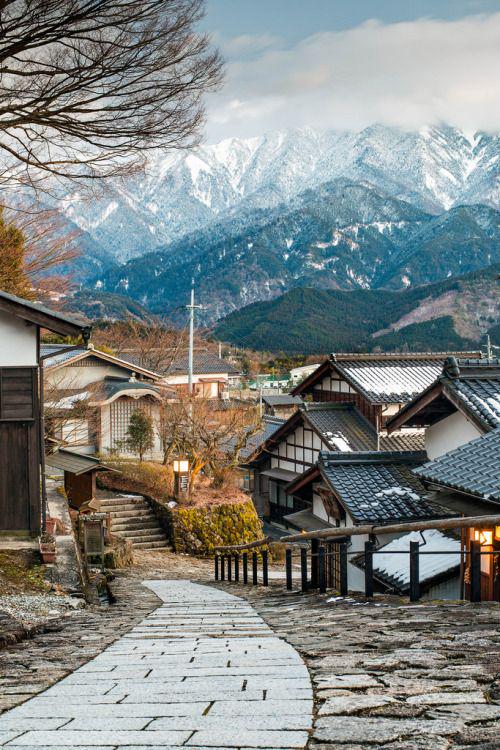
Jigokudani Monkey Park (地獄谷野猿公苑) is in Nagano Prefecture, Japan. It is part of the Joshinetsu Kogen National Park (locally known as Shigakogen), and is located in the valley of the Yokoyu-River, in the northern part of the prefecture. The name Jigokudani, meaning "Hell's Valley", is due to the steam and boiling water that bubbles out of small crevices in the frozen ground, surrounded by steep cliffs and formidably cold and hostile forests.

The heavy snowfalls (snow covers the ground for 4 months a year), an elevation of 850 meters, and being only accessible via a narrow two kilometer footpath through the forest, keep it uncrowded despite being relatively well-known.

It is famous for its large population of wild Japanese macaques (Macaca fuscata), more commonly referred to as Snow Monkeys, that go to the valley during the winter, foraging elsewhere in the national park during the warmer months. Starting in 1963, the monkeys descend from the steep cliffs and forest to sit in the warm waters of the onsen (hot springs), and return to the security of the forests in the evenings.

Macaques enjoying an onsen in Jigokudani Monkey Park in Nagano

The valley base at Jigokudani in June


地獄谷野猿公苑では長野県、日本にある。それは、(地元で志賀高原として知られている)上信越高原国立公園の一部であり、県の北部に、Yokoyu-川の渓谷に位置しています。 「地獄の谷」を意味する名前地獄谷は、険しい崖と恐ろしく寒いと敵対森に囲まれ、凍土の小さな割れ目から泡蒸気に起因すると沸騰水です。

大雪(積雪が4ヶ月~1年のグランドをカバー)、850メートルの標高、と森の中を細い2キロの歩道経由でのみアクセス可能であることは、比較的よく知られているにもかかわらず、混雑していないそれを維持する。

それは、暖かい季節に別の場所で国立公園の採餌、冬の間の谷​​に行くより一般的に雪のサルと呼ばれる野生のニホンザル、その大規模な人口のために有名である。 1963年に開始し、サルは温泉の暖かい海に座って、そして夜に森のセキュリティに戻るには、急な崖や森林から降りる。
Read On >>>

Saturday, July 25, 2015

The Kiso Valley (木曽路)

The Kiso Valley (木曽路) is located in Nagano Prefecture, and runs alongside the mountains of the Central Alps. An ancient 70 km trade route called the Kisoji was developed along the valley and served as a very important means of commerce in the area.

Embedded image permalink

The Kisoji became even more important from the beginning of the Edo Period, when it was amalgamated with other routes in the formation of the 500 km long Nakasendo. The Nakasendo ("path through mountains") was one of the two means of transportation between Edo and Kyoto. It contrasted with the other principal transportation route of the time, the Tokaido, which ran along the sea shore.


Because of restrictions by the shogunate, travelers were almost always forced to make their trips on foot. As a result, "post towns" developed every few kilometers to provide travelers with places to rest, eat, and find nightly accommodation during their arduous journey.

Along the Kiso Valley, a few post towns, particularly Magome, Tsumago and Narai, have been preserved to look as they did when they served travelers of the Nakasendo. Visitors are able to enjoy the stone paths and wooden buildings of a bygone era.

Read On >>>